Site Description
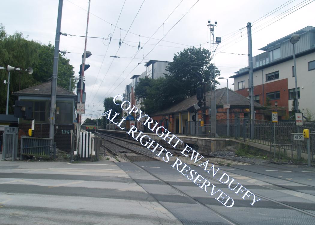
After passing under the western end of Lansdowne Road rugby stadium, the line crosses a level crossing and enters the station. Opened in 1870 under an arrangement whereby the DW&WR paid half of the cost upfront, with the local population paying the other half initially, the railway company having the right to buy them out if profitable (which they did), there are both Up and Down platforms with the station building on the Up platform. A subway connects the two platforms and previously acted as a public walkway under the line. There is ramp access to both platforms. The former signal cabin, which is on the Down side immediately after the level crossing, houses an Emergency Barrier Control, but is not used on a regular basis. The rail overbridge at the south end of the station which carries the line over the River Dodder has been a regular source of concern to the railway companies that have owned the line. The opening of the D&KR in 1834 was delayed due to the river in flood washing away the bridge here. The Dodder burst its banks again in 1839, arising out of which, the D&KR built the path along the south side of the river as an ex-gratia offer to the residents of the Pembroke Estate, who claimed that the coming of the railway was responsible for the incident! Damage to the bridge was identified in an inspection on 27 October 2011 due to two trees lodged in the bridge arch during flooding. The line was closed to facilitate repairs and reopened on November 8 2011. Immediately south of the bridge, a facing siding diverged on the Up side to serve the RDS. Opened in 1893, the connection was removed in 1971. On the Down side can be seen 12 cottages, built by the DW&WR for railway employees, but now privately owned. These are on the site of the original D&KR railway works.Photographs
Photo Gallery - Lansdowne Road Station
Google Street View - Lansdowne Road Station
Geograph.ie - Train at level crossing (Link checked 28072021)
Geograph.ie - Station (Link checked 28072021)
Geograph.ie - Crossing (Link checked 28072021)
Geograph.ie - Station (Link checked 28072021)
Geograph.ie - Train at level crossing (Link checked 28072021)
Links
Irish Rail Station Information - Lansdowne Road (Link checked 28072021)
Chronological Details
| Opened | Closed | Company | Name | Notes |
|---|---|---|---|---|
| 01/07/1870 | 31/12/1871 | D&KR | Lansdowne Road & | |
| 01/01/1872 | / /Open | D&KR | Lansdowne Road |
Geographical Details
| Section Start | Section Finish | Distance | Milepost | Measured from |
|---|---|---|---|---|
| Connolly Station | Rosslare Europort | 2.09 | 1 | Pearse Station |