www.industrialheritageireland.info

Industrial Heritage Gazetteer

Ballyvary Station
County Mayo
Latitude 53.893155 Longitude -9.1640487
Grid Reference M 2352994359
Last Visit Date 13/04/2025


View Larger Map


Site Description

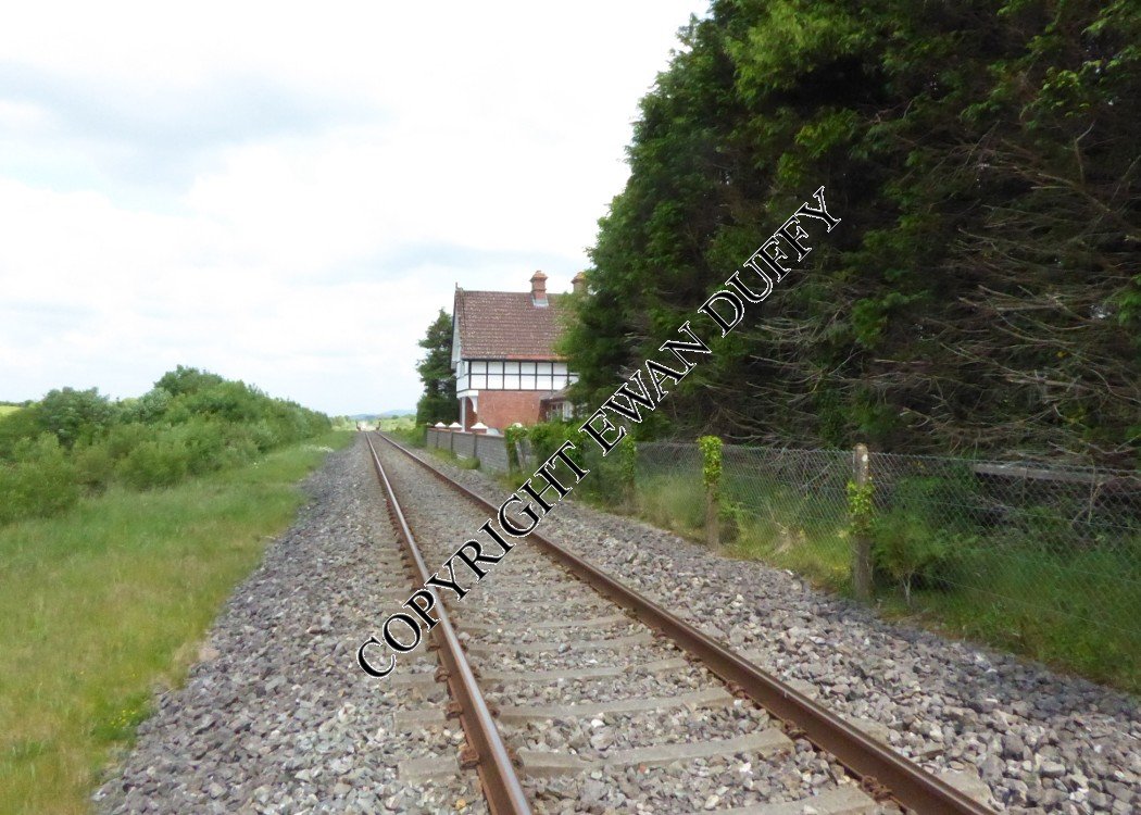
Approaching the station, there is an accommodation crossing south of the station. The single platform here is on the Up side, on which is the former station building. The track has been raised since this closed in 1963, with the result that only the platform coping can be seen. There was previously a signal box beside the crossing. This closed in 1940 and was never a block post. No trace remains of the goods area, which was at the Manulla Junction end of the station on the Up side and contained a store and loading bank and was reached by a trailing siding. The Nephin Beg mountain range can be seen in the distance on the Down side between here and Straide.

Photographs


Photo Gallery - Ballyvary Station

Links

Chronological Details

Opened Closed Company Name Notes
19/06/1894 14/06/1963 MGWR Ballyvary

Geographical Details

Section StartSection FinishDistanceUnitsMilepostMeasured from
Manulla Junction Ballina 4.44 Miles 150.5 Broadstone Station

Site Navigation


Return to Map33

Footnotes

COPYRIGHT NOTICE

COPYRIGHT EWAN DUFFY 2010 - : ALL RIGHTS RESERVED. COPYRIGHT SUBSISTS IN THE CONTENT OF THIS PAGE. YOU MAY NOT SAVE A COPY OF THIS AND/OR REPRODUCE THIS IN ANY PUBLICATION AND/OR ON ANY WEBSITE WITHOUT THE EXPRESS WRITTEN CONSENT OF EWAN DUFFY. STANDARD CHARGE FOR REPRODUCTION IS EUR100,000.00