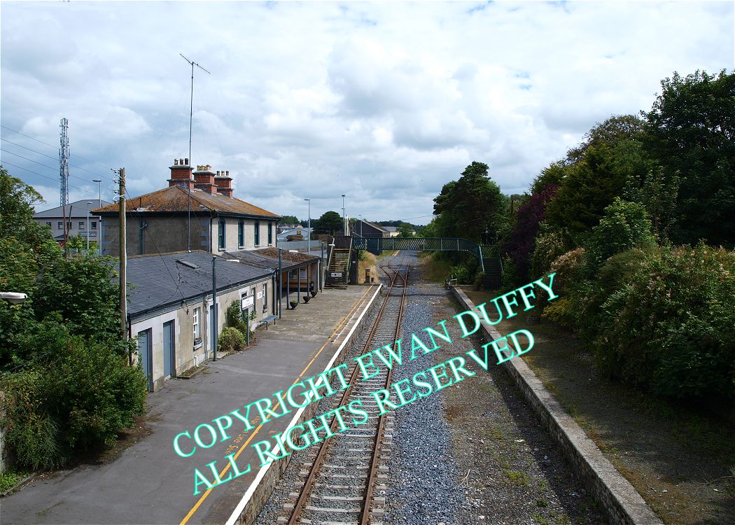
Site Description
The former cement terminal is on the Up side just before the station. This area contains a siding off the mainline and a loop off this, access to which is controlled by a 3 lever ground frame at the Ballybrophy end of the Down platform. This was previously housed in the signal cabin, which is at the Killonan end of the Up platform. There are two platforms here, but that on the Down side is disused, since the signal cabin ceased to be a block post in 1989. The station building is on the Up platform. A disused footbridge connects the two platforms. Leaving the station, the line passes under a two span road overbridge. Between Nenagh and Birdhill, the line passes through a valley with the Silvermines mountains on the Down side and the Arra Mountains on the Up.Photographs
Photo Gallery - Nenagh Station
Google Street View - Nenagh Station
Geograph.ie - Nenagh signal cabin (Link checked 16092013)
Geograph.ie - Nenagh Railway Station (Link checked 16092013)
Geograph.ie - Nenagh Railway Station (Link checked 16092013)
Links
NIAH - Nenagh Station (Link checked 16092013)
Irish Rail Station Information - Nenagh Station (Link checked 16092013)
Chronological Details
| Opened | Closed | Company | Name | Notes |
|---|---|---|---|---|
| 05/10/1863 | / /Open | GS&WR | Nenagh |
Geographical Details
| Section Start | Section Finish | Distance | Units | Milepost | Measured from |
|---|---|---|---|---|---|
| Ballybrophy | Limerick Colbert | 29.83 | Miles | 29.75 | Ballybrophy Station |