Site Description
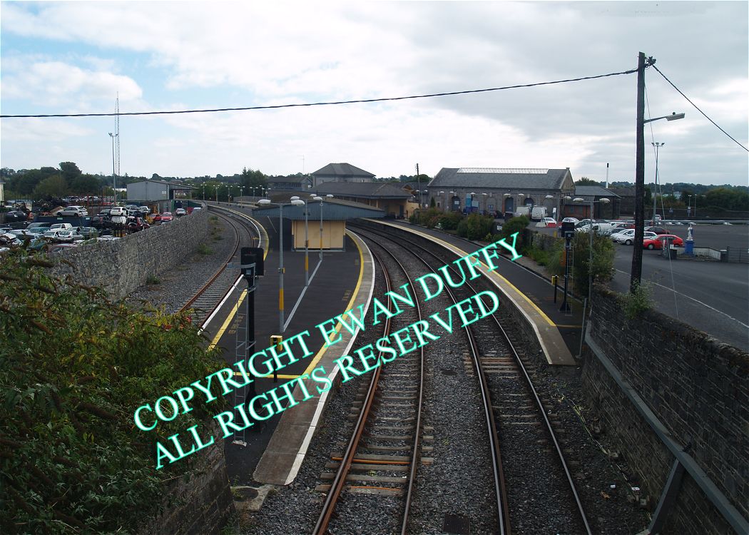
Approaching the station from Dublin, there is a racecourse on the Down side. The original Mullingar station was in the vicinity of this point. Just before the present station, the rumpof the former line to Athlone and Galway / Westport diverges on the Down side. This was originally a full double track junction. This was removed in 2004-5 and the present single line junction created, to facilitate the extension of the Down Sligo line platform to 174m. The bulk of the route is now the Old Rail Trail, a greenway with the line cut short. There is also a siding to a bay platform on the Up side. This previously gave access to a former goods area known as Buckley's Siding. A 'V' shaped platform serves both the Down Sligo and former Up Galway lines, with the Up Sligo and former Down Galway lines having platforms of their own. There is a waiting room on the latter, as well as a canopy. The station building - which dates from 1857 - and disused signal cabin are on the 'V' platform. A subway connects the two outer platforms to the centre platform and the station building. That to the former Down Galway platform has been blocked off. This job was originally done by a footbridge. The circular section of the station building saw use at one stage as tea rooms, but now houses the ticket office and waiting area. The Up Sligo platform has a waiting shelter on it and a canopy for both it and the Dublin facing bay. The former Down Galway platform is partially covered by a canopy. There is a water tower at the Galway end of the same platform. The former goods store is between the mainline and the branch.Photographs
Photo Gallery - Mullingar Station
Google Street View - Mullingar Station
Links
Buildings of Ireland.ie - Mullingar Station (Link checked 21112013)
Irish Rail Station Information - Mullingar Station (Link checked 21112013)
Chronological Details
| Opened | Closed | Company | Name | Notes |
|---|---|---|---|---|
| 02/10/1848 | / /Open | MGWR | Mullingar |
Geographical Details
| Section Start | Section Finish | Distance | Milepost | Measured from |
|---|---|---|---|---|
| Mullingar | Athlone Midland | 0 | 50.25 | Broadstone Station |
| Connolly Station | Sligo | 51.68 | 50.25 | Broadstone Station |