Site Description
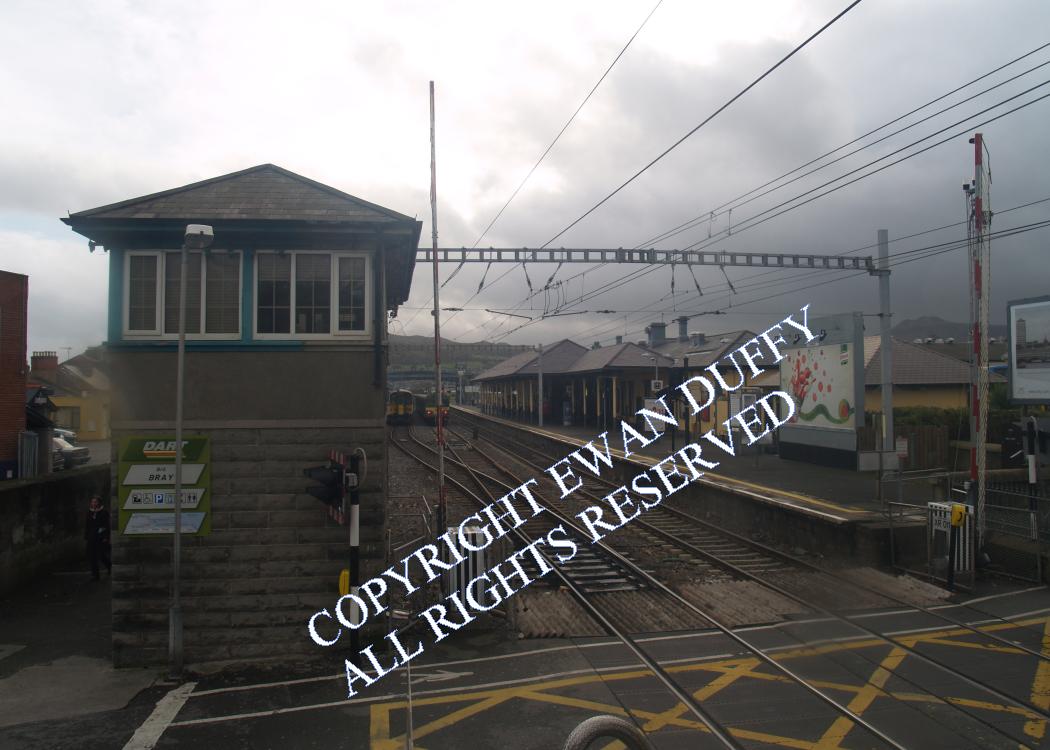
Approaching the station, the original line trailed in on the Down side, before the line crosses the River Dargle. Bray Harbour is on the Down side. On the Up side is the disused cattle bank, on which are an electricity substation and switch house for the DART and a car park. There were previously sidings here. Opposite this is a disused wheel drop. There is a level crossing at the Dublin end of station, immediately after which is the normally disused signal cabin, although this can be brought back into use to control the level crossing in an emergency. There was previously a footbridge north of the level crossing - this was removed in 2011. There is a third road between the platforms which, although occasionally used for DART stabling, is a fully signaled through road. The station building, complete with canopy, is on the Up platform. The down platform was built in 1927 and is still colloquially known as the 'new' platform! There is a canopy over part of this, painted on the supporting wall of which are murals, running from 1850 to 1980, as well as one of William Dargan. These contain two errors, namely, Bray opened in 1854, not 1852 and the station was renamed "Daly" in 1966, not 1922. There is a plaque on the station concourse commemorating this latter event in 1966, although the suffix is rarely, if ever used. Wheelchair access is provided through a remote controlled gate at the Dublin end of the Down platform. There is a water column at the Rosslare end of this, after which is the signal interlocking and radio aerial. The Down platform is connected to that on the Up side by means of a footbridge. Behind this on the Down side was the former charging plant for the erstwhile Drumm Battery trains, which ran between here and Dublin. This building was senselessly demolished by Irish Rail. There is a south facing bay platform on the Up side that was used for Greystones trains and now sees use as a storage siding for DART units. Leaving the station, the former goods area is on the Up side. The outer wall of the goods store remains, the store proper having been demolished to make way for apartments. On the Down side is the roofless, former loco shed, now in use for stabling DARTs. Opposite, there is a further siding, beyond which, the "Wicklow sidings" are passed.Photographs
Photo Gallery - Bray Station
Google Street View - Bray Station
Geograph.ie - Bray Station (Link checked 27072021)
Geograph.ie - Bray Station (Link checked 27072021)
Geograph.ie - Train approaching Bray Station (Link checked 27072021)
Geograph.ie - Bray Station with anhydrous ammonia train (Link checked 27072021)
Geograph.ie - Bray Station (Link checked 27072021)
Geograph.ie - Bray Station (Link checked 27072021)
Links
Dictionary of Irish Architects - Bray Station (Link checked 27072021)
Irish War Memorials - Bray Station (Link checked 27072021)
Irish Rail Station Information - Bray (Link checked 27072021)
Chronological Details
| Opened | Closed | Company | Name | Notes |
|---|---|---|---|---|
| 10/07/1854 | / /Open | D&WR |
Geographical Details
| Section Start | Section Finish | Distance | Milepost | Measured from |
|---|---|---|---|---|
| Connolly Station | Rosslare Europort | 14.49 | 12.25 | Pearse Station |