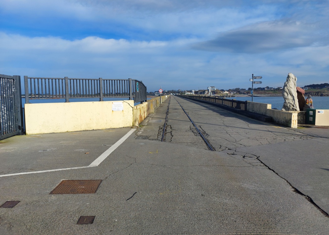
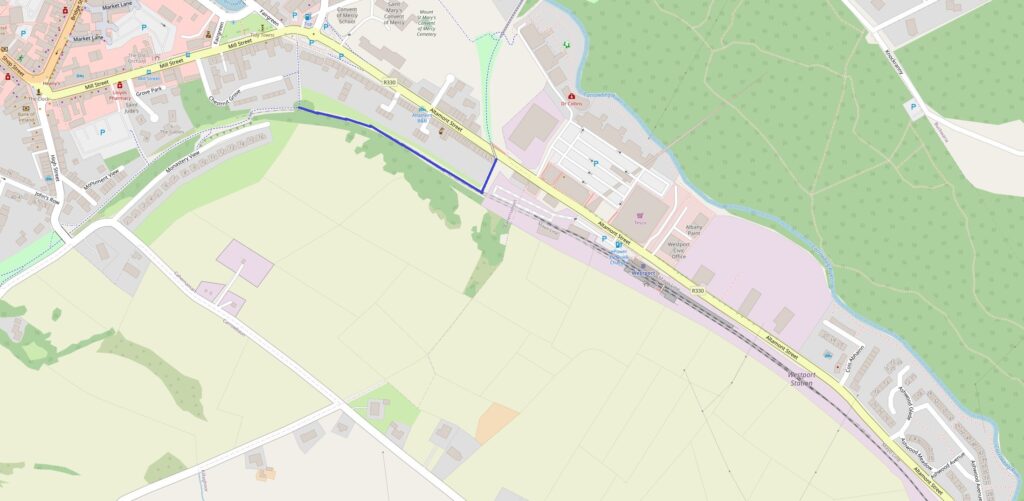
I have finally gotten around to starting the processing of the images I took of the Youghal Greenway just after Christmas (this took a while as multiple culverts/accommodation bridges etc had to be added to my Access database as a location and geo-referenced).
Looking at the aerial views of Midleton station online, CIE have kept a large amount of land east of Midleton station, which requires the greenway to Youghal to be diverted around this site before joining the original trackbed near to Broomfield Bridge.
Is this the site of the future CART depot (Cork Area Rapid Transit)?
Another weekend, another trip to Northern Ireland. Due to the realpolitik of driving a Republic of Ireland registered car, I have tended to prioritise taking photographs of historic station locations in the Republic of Ireland over Northern Ireland.
This weekend, through combination of bike and train, I successfully visited many former station sites on the railway between Belfast and Larne Harbour.
However, this post is about Grand Central Station. I had the need to use the facilities in the station and, notwithstanding that the station is only open for 4 months, one of the 5 stalls in the gents was out of order, the lock on the door of another stall was missing and the stall I used, the hi tech “button” to flush the toilet did nothing (i.e. failed to flush).
Therein lies the problem with State investment. Governments will provide a lot of money for one off investment in capital projects, but not a red cent towards ongoing maintenance costs. Having said that, I’d have expected the facilities in Grand Central to still be operational 4 months after opening.
I traveled southside for the first time in a long while today to photograph the stations from Glenageary to Bray.
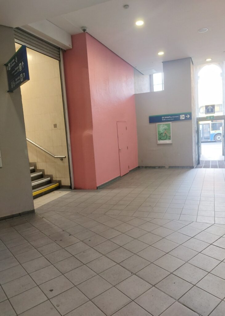
At Shankill, I noted that Irish Rail has taken de-staffing to the extreme by walling up the ticket office, leaving a building with no ability to staff it (reminder to IR – the present byelaws don’t reference TVMs – if no staffed ticket office, technically, there is no need for a ticket).
Anyway, the thought struck me, as there is separate access to both platforms not going through what was the ticket office, why maintain this building?
Notwithstanding that it was built in the 1970s as a ticket office, it would surely be within the capability of CIE, the property development company, to repurpose this as a 1 bed house and sell it. Bijou residence, adjacent to DART station, council owned carpark adjacent where a resident’s permit could be arranged. They could even throw in a villa ticket* to smooth the sale.
* Villa tickets were a 19th century idea of the (private sector) railway companies. They were typically granted by the railway company to anyone building a new house in designated areas near to the companies’ stations for a period of up to 10 years, the idea being that this would encourage such development and increase the usage of the railway line in the process.
I found this video on YouTube which explains the track layout at Connolly Station in Dublin very well whilst covering the issue of why the station is a bottleneck.
There are a few significant Youtube content creators in the railway sphere, providing material/commentary on railways locally/globally. One of these is Reece Martin in Canada, whose channel RM Transit is well worth a visit.
RM Transit has just dropped a video about the railway/tramway network of Dublin (see below). I have watched and left a comment on the video with clarifications/background info.
Whilst I don’t think my comment will be deleted, I repeat the comment here to provide additional context to what was published:
A few comments on this. Generally OK, but I would dispute that LUAS is the backbone of the transit system – that would be the heavy rail (both DART and diesel services).
The LUAS spur to Connolly Station was the original terminus of the line, which ran initially from Connolly to Tallaght. There was a subsequent extension of the line to The Point, which left Connolly on a spur.
The LUAS Green line was originally planned to be in a cut and cover tunnel through the city centre but business interests objected and the Irish Government caved into their objections. Co-incidentally, the politician who did this (Mary O’Rourke) passed away recently.
Originally, the heavy rail Harcourt Street line did connect to the coastal line to Bray, however, south of Cherrywood, the local authority has permitted housing to be built on the original alignment, cutting off the possibility of a return.
The genesis of DART goes back to the combination of north/south commuter services post 1958 when trains started to run from Howth to Bray. This became the original electrified section.
The reason for the northside DART stations being in a cutting with ramp access is twofold. The Dublin & Drogheda Railway (original company) built their line without level crossings (hence the cutting) and they had a pathological also hatred of footbridges. Most stations on their line used an adjacent road bridge to connect the platforms rather than provide an internal footbridge.
The conversion of the Green Line LUAS south of Charlemont to Metro is required due to capacity constraints, however, when the LUAS was being planned, the designers stupidly removed the 1850s grade separated embankment south of Ranelagh, which introduced a level crossing at the modern day Beechwood station. Recent proposals to close off this crossing were dropped due to voter objections.
I am interested in your source for the planned 4th through track at Connolly Station, not being sure where the space for this is (a look at Googlemaps would confirm this). The main problem with the line from Connolly Station to Pearse Station is that it was built on the wrong side of Connolly Station – 19th Century laissez faire British politics. That Pearse Station faces south and not north is another problem.
I was out and about in Dublin recently and spotted a new map on the DART:
What caught my eye was the marking of the Short Hop Zone at its current boundaries of Balbriggan, Kilcock, Sallins & Naas and Kilcoole. These would be the boundaries that the National Transport Authority are proposing to reduce in geographic area, which would require new maps to be produced.
Or the railway from Ballybrophy to Killonan for the uninitiated.
This little used railway line (2 trains a day each way and only 1 on Sunday) runs from Ballybrophy (on the Dublin to Cork line) to Killonan – a junction just over 4 miles east of Limerick Station.
Strangely enough for such a line, it has 4 block posts on it, counting the terminal points (Ballybrophy, Roscrea, Birdhill and Killonan). Great you might think, if either of the two trains a day gets out of path, there is the ability to change crossing points.
Except that the two services a day are provided by the one unit and don’t cross anywhere on the line. In addition, whilst Roscrea and Birdhill have two platforms, the Up platform in each case is inaccessible due to no footbridge connection. This latter has become something of an IR standard at “crossing” points, rendering such locations effectively useless for crossing service trains.
In addition, in terms of crossing point location, if you were to design a railway in terms of ideal crossing points, it is unlikely you would do it in this manner. The rough mileages of the crossing points are:
Ballybrophy 0
Roscrea 10
Birdhill 42
Killonan 52
Spot the 32 mile single line section in the middle, giving Boyle to Sligo at only 28 miles a run for its money.
Given that there is full CTC at Ballybrophy and Killonan, the more sensible approach would be to install axle counters (now that track circuits are verboten) at each end of the line and operate it as one 52 mile branch. This would allow the property development company with the inconvenience of a public transport network attached to dispense with the costs of manning 2 signal cabins and associated ETS equipment.
One of the many things on my to do list is to learn how to fly a drone, given the enormous possibilities it offers in the arena of IH recording.
In advance of that happening (no scheduled date unfortunately), I link to this Youtube channel, by the name of DroneHawk, (I don’t know who the owner/content creator of the site is) which has excellent footage of both recent engineering works, such as the Dunkettle interchange/Foynes railway relaying and footage of historic railway alignments.
Proponents of the Ulster Canal Thon Sheugh like to tell us that this is a wonderful tourist attraction that will revitalise Clones and all other areas that the canal served.
Certain Leitrim county councillors are trying to blame this on fees charged by Waterways Ireland and are calling for the proposed fee increases that WI are seeking to be deferred.
From the Leitrim Observer (linked to above):
“The numbers have fallen from about 100,000 in the mid 1990s to 76,000 in 2004 and down to 36,000 in 2023. It looks like it’s going to dip under 30,000 this year,” explained Cllr Flynn.
If the premier boating resource in Ireland is seeing a natural decline in usage, what makes anyone think that a dead end canal to Clones will see sufficient activity to justify its restoration?