The infamous Iron bridge in Coalbrookdale, Shropshire, is the subject of an interesting Youtube video by well known Youtuber Tom Scott.
Author: ewan.duffy
Categories
Heritage Week 2026
As is customary for this time of year, I have reviewed the Heritage Week site and compiled a listing of events of IH interest.
Wait, what, I never expressed an opinion on anything in Mayo – oh, not me.
The Western People reports that Fine Gael Senator Mark Duffy (no relation) has welcomed the building of a passenger shelter at Manulla Junction. IMHO, describing this as a “long awaited Mayo rail facility” is a stretch of the imagination.
Categories
Belcoo & Blacklion Station
The former station at Belcoo & Blacklion, in Co. Fermanagh but close enough to Blacklion in Co. Cavan to have the latter place in its name, was a station on the former Sligo, Leitrim & Northern Counties railway line from Collooney, Co. Sligo to Enniskillen, Co. Fermanagh.
The station and line closed in 1957 by virtue of an edict of the Northern Ireland Government to close most the GNR(I) railway lines west of the River Bann. This led to other line closures by virtue of the loss of connectivity, including the still independent SL&NCR.
The station building in Belcoo is currently for sale. I will not be expressing an interest in it as it is in Northern Ireland rather than in the Republic.
Categories
River Liffey pollution
Following on from the €50m IT fiasco, Irish Rail is embroiled in another scandal. The Journal reports that fuel storage facilities owned by Irish Rail at Connolly Station are believed to be leaking into the River Liffey with all the negative consequences that this entails.
This has shades of the problem uncovered in 2019 where ESB power cables were leaking oil into the Grand Canal in Dublin.
Categories
Common sense prevailing on Irish Rail
I spotted this notice on the side of the ticket machine at Kilcock station last week.
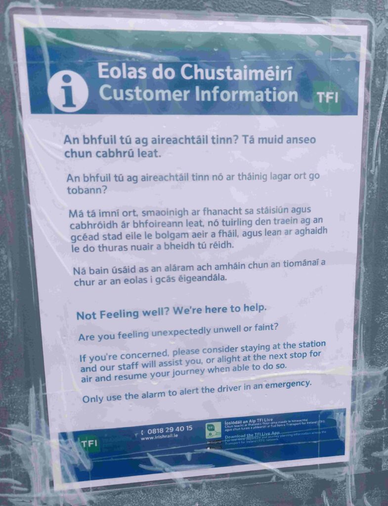
In a rare outbreak of common sense in Ireland, Irish Rail is encouraging those who are not feeling well to alight from the train and await assistance at the nearest station, which (cue all the haters), IMHO, is a better outcome than holding a train at a station waiting for assistance to arrive for 1 passenger.
The London Underground has had similar signs at their stations for years and I am pleased to see Irish Rail is starting to follow suit.
Categories
Electricity costs in Ireland
I normally work on the basis of not believing anything government related until it has been officially denied by RTE or the BBC.
Having said that, in a rare act of explaining something in simple English, RTE has a very good article explaining why electricity costs in Ireland are the highest in Europe.
TLDR, electricity is more expensive in Ireland due to:
- Higher costs generally, which then feed into supplies/staff costs/taxes etc borne by electricity providers
- Higher wages/salaries in Ireland relative to other countries
- The size of Ireland’s grid.
I was pleasantly surprised to see this last one mentioned as normally, anything that implies that the proliferation of one off housing in rural Ireland comes with a price tag is deemed to be the elephant in the corner of the room and is not talked about or, worse still, its existence is denied.
Categories
What’s €50m between friends?
RTE reports that Irish Rail have written off €50m spent on a failed IT train management system. Maybe if IR were to show the same zero tolerance towards its own behaviours as it does towards the public, there would be a better result.
RTE reports that Cork City Council is to acquire the former counting house of the erstwhile Beamish & Crawford Brewery in Cork City, with plans to redevelop the building as the city library.
Categories
Thanks to Ruairi Quinn
In 1994, in his capacity as Minister for Enterprise & Employment, Ruairi Quinn introduced the May bank holiday in the Republic of Ireland, to take place on the 1st Monday in May each year.
As a result of this, I was able to spend yesterday and today photographing the railway lines from Collooney to Claremorris (yesterday) and Claremorris to Athenry today.
In the case of latter, in addition to re-photographing the stations, I also visited most publicly accessible bridges and level crossings, the reason being that the noise around the potential restoration of all (Athenry to Claremorris) or part of this line (Athenry to Tuam) is getting louder.
As such, these photographs will form a record of the line before any such restoration takes place.
With 200 images taken over the 2 days, it will take me a while to process and upload these to the site.