The BBC have a video article about mines in Northern Ireland.
Categories
Posts of an historical nature
The BBC have a video article about mines in Northern Ireland.
RTE has an article entitled “Enemy lines: the conflict on Irish Railways 1922-23” on their site, looking at aspects of Ireland’s railways 100 years ago.
A worthwhile read, I did notice an error in photograph selection, with RTE publishing a stock photo from SSPL/Getty Images, which they claim is of a Great Southern & Western Railway locomotive at Inchicore Works in Dublin.
I will be the first to admit that I have little to no interest in trains (including locomotives) and I know nothing about what type of locomotive this is or anything about it.
However, I did note that the initials on the side of the locomotive are:
“G&SWR” and not “GS&WR”.
A small difference, but significant in ruling this out as an Irish locomotive and also determining that the photo is not Inchicore.
There was a British railway company – the Glasgow & South Western Railway – the initials of which were “G&SWR”.
In 1862, the Dublin & Meath Railway opened their line from Clonsilla, Co. Dublin to Navan, Co. Meath – their station in the latter being located to the south of the railway from Navan to Oldcastle, which was a separate company.
At the Dublin end of the line (Clonsilla), the company had their own locomotive shed, located in the apex of their line and the MGWR mainline to Galway/Sligo.
This building was later converted for use as accommodation for railway staff, but has been derelict for decades and overgrown with plant life.
When out volunteer litter picking on the Royal Canal today, I noticed that the side of the building facing the modern era M3 Parkway branch has been cleared of vegetation, exposing it to public view once more.
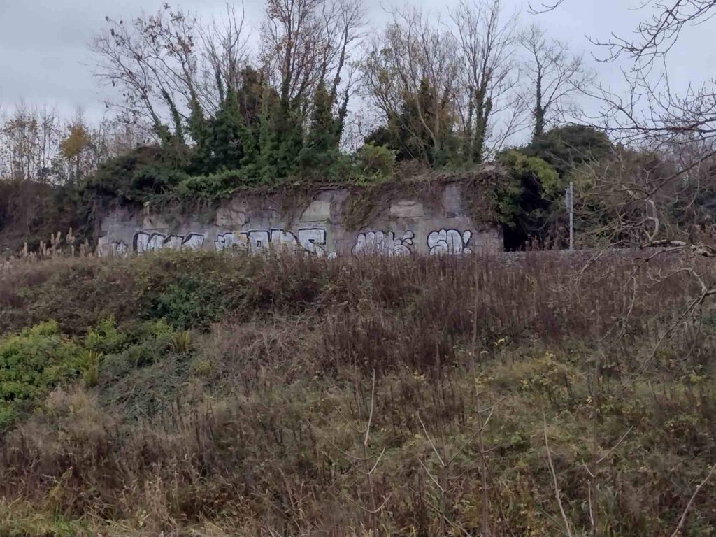
I hope that this is not a prelude to demolition of the building.
They say you learn something new every day.
I was aware that historically in Ireland, copper was retrieved from bogs by burning it. I was unaware that iron ore can be similarly retrieved but the Irish Independent have an article about a blacksmith who uses Irish bog ore iron in his work.
Not for the first time, I link to a YouTube video by Tom Scott – in this case, he is demonstrating the use of a replica treadmill crane, which is believed to have been in use in Continental Europe in the early part of the 2nd millennium.
RTE have an interesting video clip about a 1977 robbery of mail vans in Sligo whilst leaving Sligo train station. One of the vans was crashed into a mine adit in Arigna and the contents searched for valuables outside the mine.
The Irish Independent reports on the launch of the Dublin Port online archive, an initiative by the Dublin Port Company to digitise and make available online the company’s archival collection of photographs, maps, etc.
The collection can be accessed at https://www.dublinportarchive.com/
Another of the buildings featured in RTE’s 100 Buildings series is worth linking to – Derrinlough Briquette Factory in Co. Offaly.
The BBC have an article on their website in connection with the historic production of poitin on the Inishowen Peninsula.
The Mourne Wall in Co. Down is a wall delineating the catchment area of the Silent Valley and Ben Crom Reservoirs.
It is 100 years old this year and the BBC have a short video clip marking this occasion.